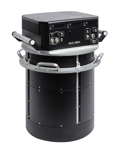
PAS 880i NIR
Oblique and Nadir System
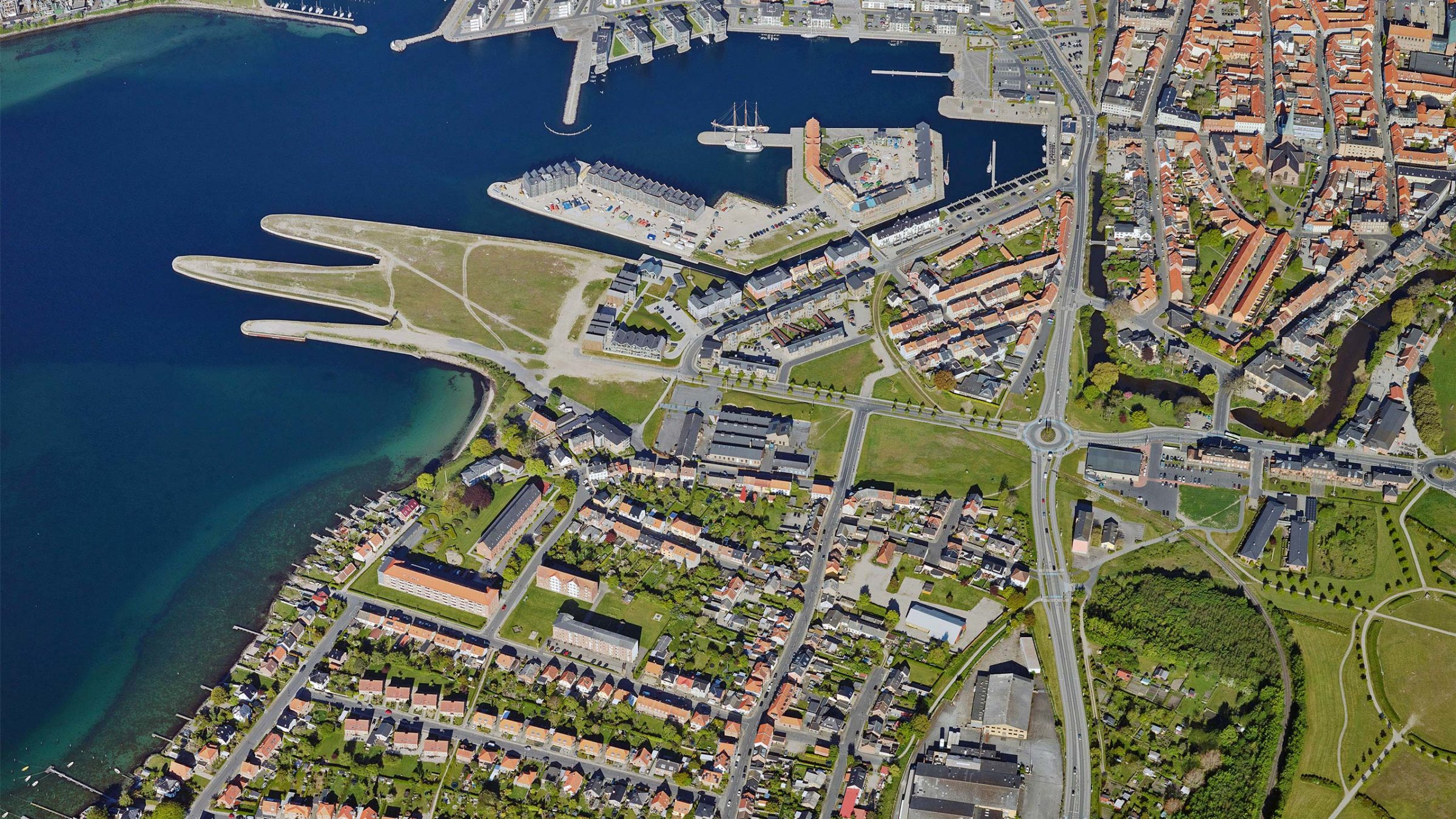
Most efficient all-in-one solution for wide-area mapping and 3D city modelling
With the special engineering design, customers can achieve the highest ground resolution with the shortest flying hours and lowest data processing costs, making PAS 880i one of the most efficient all-in-one solutions for wide-area aerial mapping and 3D city modelling.
PAS 880i is a large-format nadir and oblique aerial imagery solution comprises four oblique RGB cameras of 150 MP and for nadir, a 280 MP RGB and a 150 MP NIR camera integrated into a single pod to simultaneously capture photogrammetric imagery.
Highest performance and productivity
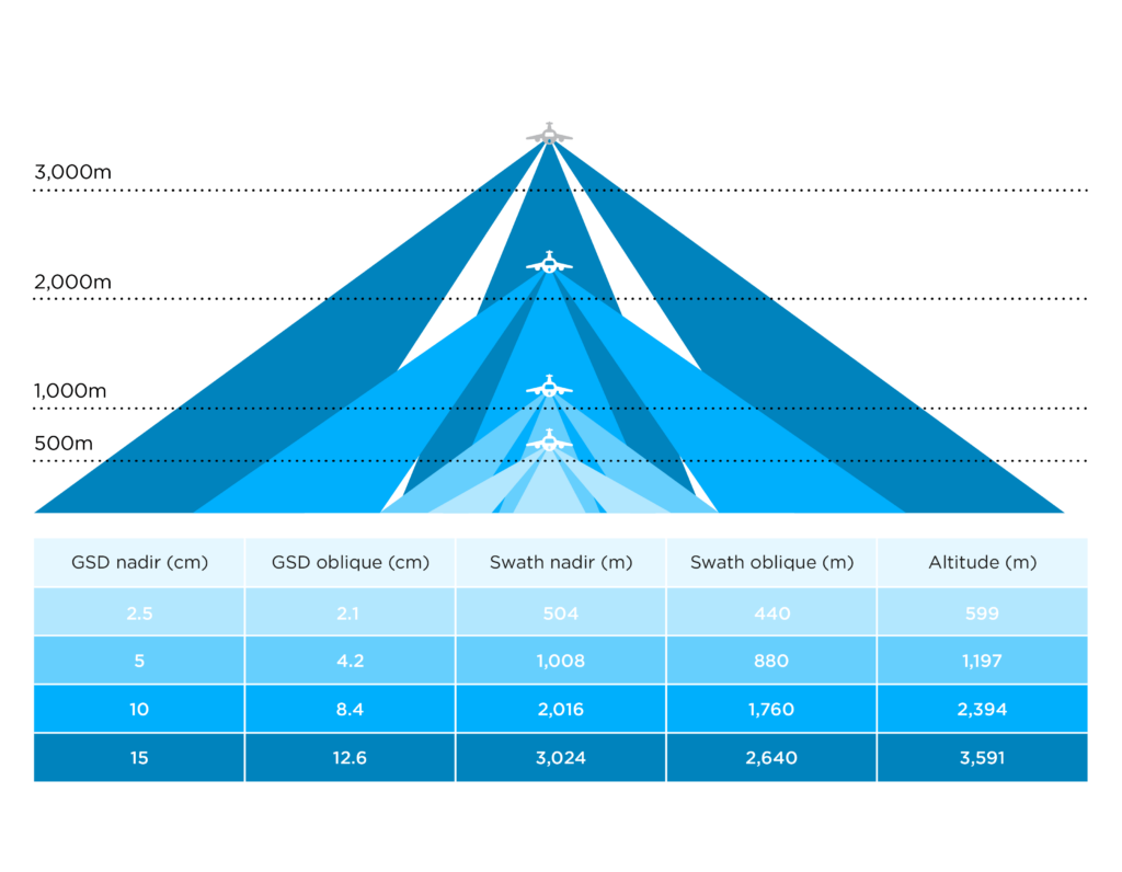
PAS 880 provides 20,000 pixels across flight lines for the nadir and 14,000 pixels for each of the oblique cameras.
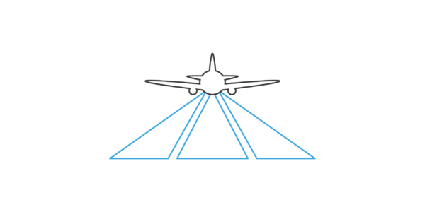
An unbeatable performance of 2 frames per second enables 80% forward overlap at high speed.
The combination of 90mm/150mm lenses for the nadir and oblique system ensures balanced ground resolution products for all cameras. The central leaf shutter provides speed up to 1/2500 sec. eliminating motion blur. The 3,76μm BSI pixels ensure sharp images under any light condition.
PAS 880 delivers the highest quality and accuracy for oblique aerial imagery.
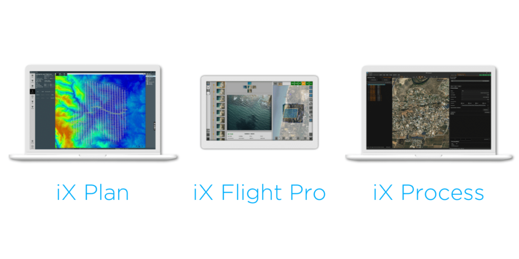
iX Suite
A new generation of Phase One flight and sensor management software
iX Suite - Data capture workflow
The PAS 880 system uses Phase One’s intuitive software package – iX Suite – designed to handle all aspects of photogrammetric project workflows, from flight planning to creating commercial format images.
The software package includes:
- iX Plan for mission planning
- iX Flight Pro for flight director, data collection, real-time image status and an option to change flight lines during the mission.
- iX Process for high-quality image processing.
Phase One designed an open system to allow for additional processing with third-party photogrammetric applications.
iX Plan - Mission planning tool
iX Plan is a user-friendly tool that provides extensive planning capabilities by importing area definition, DEM, GCP locations and reference maps. The preferred line direction is drawn and the selected polygon is then automatically filled with photography lines at the correct GSD, overlap and side lap. With iX Plan:
- Flight lines can be edited.
- Quality control GSD and coverage ensure that the planning covers all requirements.
- Flight plans can be exported to Microsoft Excel for quick estimation of project cost.
- The flight plan can be exported from iX Plan to iX Flight Pro for flight management.
iX Flight Pro - Flight and sensor management tool
iX Flight Pro, integrated in the PAS 880 control unit, contains all functions needed for flight management and image collection, from engine start to post-landing. It serves as a flight management center, interfacing with all hardware such as cameras, Applanix GNSS/IMU, Somag stabilizer, and pilot/operator monitors.
The flight director module provides position altitude and speed commands to the pilot based on mission design and planned tolerances. This easy to follow flight director graphical display enables the execution of long missions with low pilot fatigue, resulting in higher mission safety and quality. The operator monitor aids mission and image collection management. A graphical collection summary ensures that all images are captured at the correct locations and quality within the required speed and height tolerances.
Continuously displayed images and exposure value graphs allow the operator to manage camera parameters for best image acquisitions. Post-flight reports are used to decide whether the mission was successfully completed.
iX Process - Mission review, QA and image export
iX Process converts the mission data into commercial images ready for photogrammetry processing. iX Process can process large quantities of images in batches. An intuitive user interface enables generating and saving processing recipes. The recipes can then be used to process batch jobs on selected files or folders, and iX Process will display the job’s progress. iX Process enables easy export of images in TIFF, metric-corrected TIFF, or jpeg files.
Precision trajectory
Direct georeferencing is essential for cost-effective photogrammetry processing. Phase One’s PAS 880 system software includes the Applanix POSPac, the Aided-Inertial post-processing software package for mapping applications.
Inaccessible regions without Continuously Operating Reference Stations (CORS) can be mapped without the cost of deploying local base stations. POSPac uses data recorded by the onboard flight unit and the Trimble® RTX™ technology (or a customer base station) to provide centimeter-level precise trajectory and image 6 DOF lists, enabling direct georeferencing.
-
iX Suite Software
iX Suite - Data capture workflow
The PAS 880 system uses Phase One’s intuitive software package – iX Suite – designed to handle all aspects of photogrammetric project workflows, from flight planning to creating commercial format images.
The software package includes:
- iX Plan for mission planning
- iX Flight Pro for flight director, data collection, real-time image status and an option to change flight lines during the mission.
- iX Process for high-quality image processing.
Phase One designed an open system to allow for additional processing with third-party photogrammetric applications.
-
iX Plan
iX Plan - Mission planning tool
iX Plan is a user-friendly tool that provides extensive planning capabilities by importing area definition, DEM, GCP locations and reference maps. The preferred line direction is drawn and the selected polygon is then automatically filled with photography lines at the correct GSD, overlap and side lap. With iX Plan:
- Flight lines can be edited.
- Quality control GSD and coverage ensure that the planning covers all requirements.
- Flight plans can be exported to Microsoft Excel for quick estimation of project cost.
- The flight plan can be exported from iX Plan to iX Flight Pro for flight management.
-
iX Flight Pro
iX Flight Pro - Flight and sensor management tool
iX Flight Pro, integrated in the PAS 880 control unit, contains all functions needed for flight management and image collection, from engine start to post-landing. It serves as a flight management center, interfacing with all hardware such as cameras, Applanix GNSS/IMU, Somag stabilizer, and pilot/operator monitors.
The flight director module provides position altitude and speed commands to the pilot based on mission design and planned tolerances. This easy to follow flight director graphical display enables the execution of long missions with low pilot fatigue, resulting in higher mission safety and quality. The operator monitor aids mission and image collection management. A graphical collection summary ensures that all images are captured at the correct locations and quality within the required speed and height tolerances.
Continuously displayed images and exposure value graphs allow the operator to manage camera parameters for best image acquisitions. Post-flight reports are used to decide whether the mission was successfully completed.
-
iX Process
iX Process - Mission review, QA and image export
iX Process converts the mission data into commercial images ready for photogrammetry processing. iX Process can process large quantities of images in batches. An intuitive user interface enables generating and saving processing recipes. The recipes can then be used to process batch jobs on selected files or folders, and iX Process will display the job’s progress. iX Process enables easy export of images in TIFF, metric-corrected TIFF, or jpeg files.
-
Precision trajectory
Direct georeferencing is essential for cost-effective photogrammetry processing. Phase One’s PAS 880 system software includes the Applanix POSPac, the Aided-Inertial post-processing software package for mapping applications.
Inaccessible regions without Continuously Operating Reference Stations (CORS) can be mapped without the cost of deploying local base stations. POSPac uses data recorded by the onboard flight unit and the Trimble® RTX™ technology (or a customer base station) to provide centimeter-level precise trajectory and image 6 DOF lists, enabling direct georeferencing.
Technical specifications
Sensors
Technical specifications
Oblique sensor
Nadir sensor
Frame geometry
Central projection
Central projection
Frame geometry
Central projection
Central projection
Sensor type
BSI CMOS Bayer Array
Sensor type
BSI CMOS Bayer Array
Sensor size
150MP - 14,204 x 10,652
280MP - 20,150 x 14,118
Sensor size
150MP - 14,204 x 10,652
280MP - 20,150 x 14,118
Pixel size (micron)
3.76
3.76
Pixel size (micron)
3.76
3.76
Shutter technology
Electromagnetic
Electromagnetic
Shutter technology
Electromagnetic
Electromagnetic
Shutter speed max.
1/2500
1/2000
Shutter speed max.
1/2500
1/2000
Dynamic range (dB)
83
83
Dynamic range (dB)
83
83
Light sensitivity (ISO)
50-6400
50-6400
Light sensitivity (ISO)
50-6400
50-6400
A/D conversion (bits)
14
14
A/D conversion (bits)
14
14
Aperture
f/5.6
f/5.6
Aperture
f/5.6
f/5.6
Field of view specifications
Oblique sensor
Nadir sensor
Forward/backward cameras
- Across track
45° (+10.1 / -10.1)
- Across track
45° (+10.1 / -10.1)
- Along track
45° (+7.6 / -7.6)
- Along track
45° (+7.6 / -7.6)
Left/right cameras
Left/right cameras
- Across track
42° (+7.1 / -13.1)
- Across track
42° (+7.1 / -13.1)
- Along track
42° (+7.6 / -7.6)
- Along track
42° (+7.6 / -7.6)
Nadir camera
Nadir camera
- Across track
45.7°
- Across track
45.7°
- Along track
32.9°
- Along track
32.9°
System
Technical specifications
PAS 880
Capture (fps)
2
Capture (fps)
2
Internal storage
Integrated, 6 x 2TB
Internal storage
Integrated, 6 x 2TB
GNSS receiver/IMU
Integrated, Trimble Applanix AP+
GNSS receiver/IMU
Integrated, Trimble Applanix AP+
Applanix IMU-91 / IMU-57
Data interface
USB3
Data interface
USB3
Dimensions [Ø] (mm)
408x716
Dimensions [Ø] (mm)
408x716
Weight (kg)
45
Weight (kg)
45
Operating temperature (°C)
-10 to 40
Operating temperature (°C)
-10 to 40
Humidity (%)
15 to 80 (non-condensing)
Humidity (%)
15 to 80 (non-condensing)
Storage temperature (°C)
-20 to 65
Storage temperature (°C)
-20 to 65
Sensor control software
iX Flight Pro
Sensor control software
iX Flight Pro
Peripherals
7" Pilot & 20" Operator display, Input devices
Peripherals
7" Pilot & 20" Operator display, Input devices
Stabilized mount
GSM4000
Stabilized mount
GSM4000
Average power consumption (W)
380
Average power consumption (W)
380
Max. power consumption (W)
450
Max. power consumption (W)
450
Contact a Phase One Expert
If you would like to learn more about the PAS 880 Aerial System, our experts are eager to help! Contact Us.