AGRICULTURE & FORESTRY
Monitoring Dead Trees and Preserving the Green in Yosemite Park
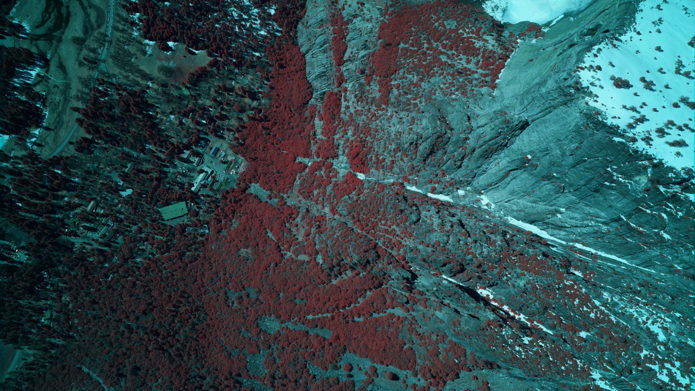
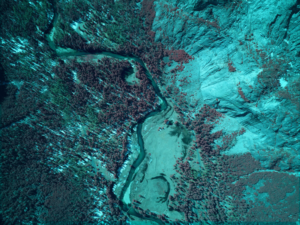
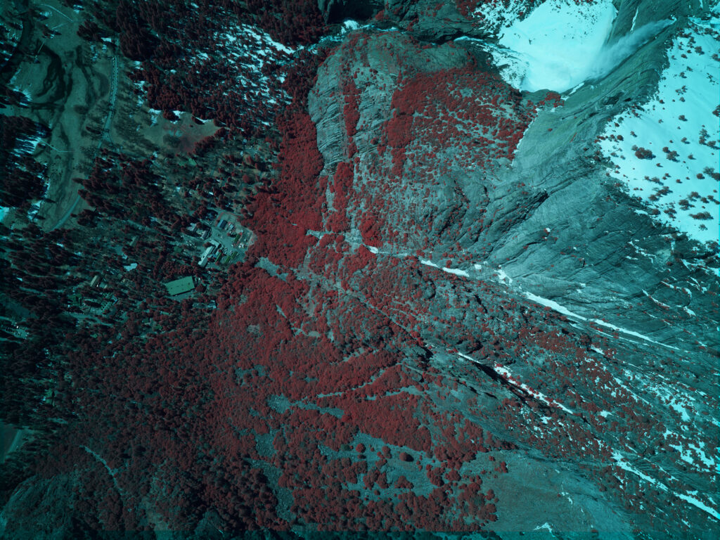
Using High Resolution 4-Band Aerial Imagery as a Tool for an Accurate Identification of Dead Trees.
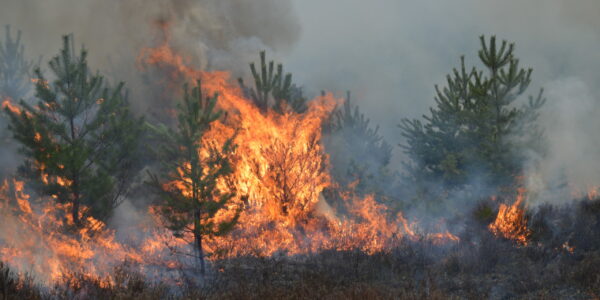
Weather Implications on Tree Health
The lack of rain and the higher temperatures has put California’s trees under considerable stress, making them vulnerable to wildfire threat and organisms damage that can kill them. An accurate identification of dead trees for efficient treatment and effective removal process that poses safety, logistical and financial risks, becomes essential to the different authorities.
Data Collection for Assessment and Planning
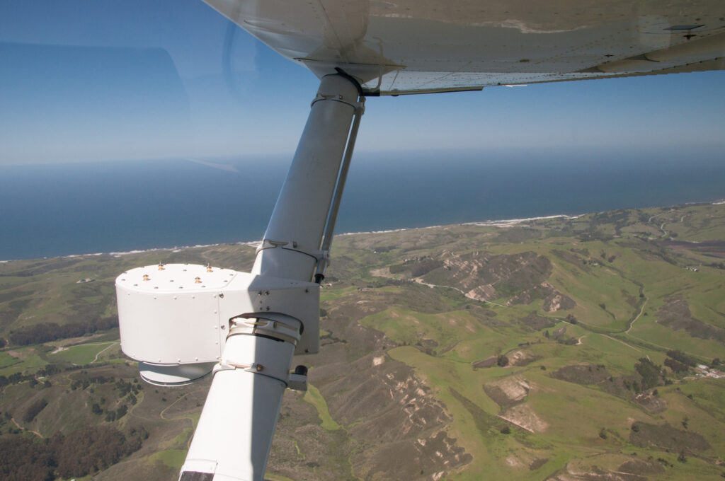
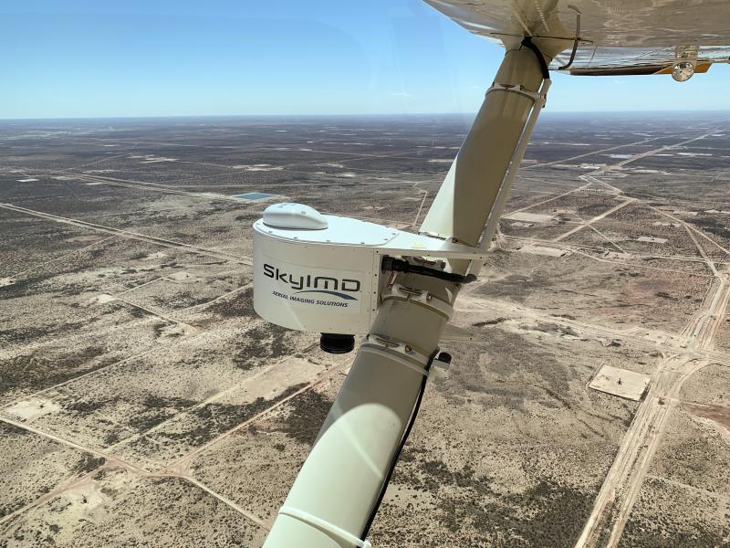
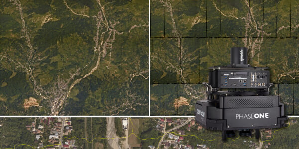
SkyIMD, one of Phase One’s top integrators, was asked to provide an Aerial imagery solution for California Transportation department, Fire department, the department of Water Resources, and several local municipal utility districts, including Yosemite National Park.
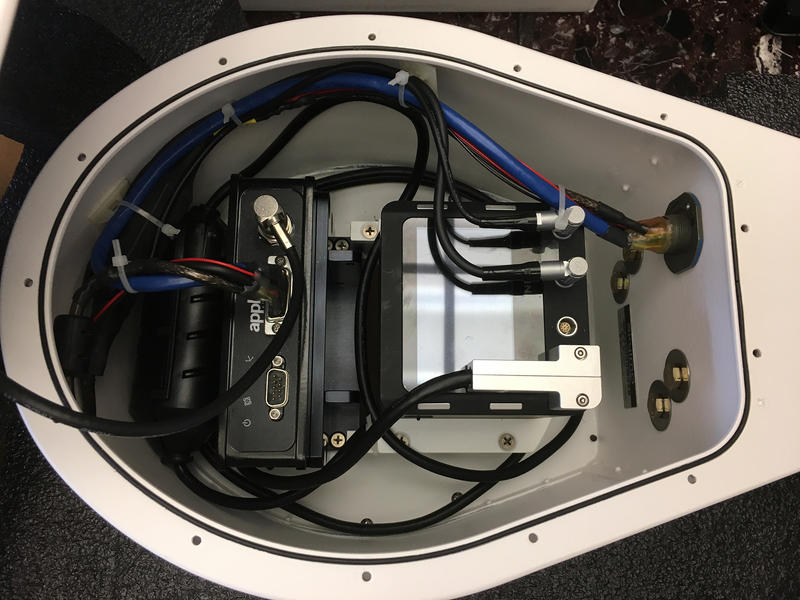
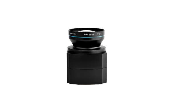
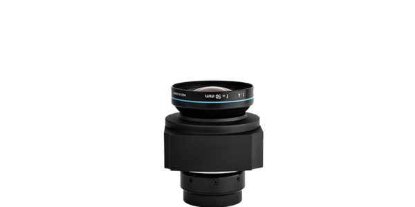
Located in California, SkyIMD designs and develops multipurpose and highly extensible aerial imaging solutions. A while ago, the company introduced a uniquely designed aerodynamic camera platform (“pod”) that is capable of housing a single or two Phase One aerial cameras and was approved for commercial aviation by the FAA and 55 other countries with over 23 popular aircrafts. The SkyIMD system utilizes Phase One’s cost effective 4-Band Solution, providing exceptional imaging capability, and fits perfectly onto the SkyiMD system’s pod.

We can fly faster, cover a greater area, and ultimately deliver data to our clients faster. We acquire more data during ideal lighting conditions and save the costs of fuel and time for everyone involved.
Coverage & Consistency
Michael Estigoy, SkyIMD COO said “Using a Phase One 100MP camera has enabled us to reduce the number of flight lines needed to cover an area by 40% and still maintain the desired overlap and GSD. For most of our projects, the Phase One is a must use. Having a metric and calibrated lens removes many of the questions we face when bidding on projects that require a high degree of accuracy and precision. Some of the most popular mapping applications, such as Pix4D, will optimize their results using this information. We’ve been involved in aerial image mapping since 2010 using a variety of camera and sensor configurations. The Phase One camera delivers results that are sharp, precise and properly exposed. We have been able to compare several different camera and lens combinations against each other and Phase One images are consistently better”.
Contact a Phase One Expert
If you would like to learn more about our Aerail Cameras, our experts are eager to help! Contact Us.

Geospatial
The PAS Pana: a 48,800-pixel camera innovated with our customer Surdex

Geospatial
Rebuilding after Hawaii’s wildfire with engineering-grade surveying

Geospatial
Revolutionizing Slovenian urban planning: Phase One’s PAS 880i redefines reality mapping
Geospatial
Imaging solutions combined with AI and 5G – A new approach and promising to assess forest health and detect and monitor wildfires
Geospatial
Phase One Cameras combined with light, fixed-wing aircraft deliver highly efficient LiDAR and mapping missions

Geospatial
Capturing Glastonbury Festival
Geospatial
Breaking barriers to offshore wind energy development
Geospatial
Using aerial oblique images combined with close range UAV (uncrewed aerial vehicles) based data
Geospatial
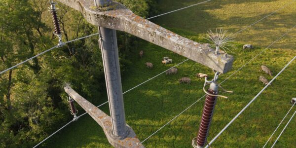
A change in the future of high-risk, critical asset inspections: fast, effective and safe aerial powerline inspection in a fraction of time and with real cost savings
Geospatial
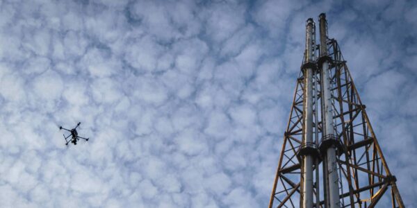
Using drone technology for Flare Stack Inspection: Getting the smallest details from a safe distance
Geospatial
The Experiences of EyeFly with Phase One iXM
Geospatial
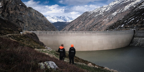
Dam Fine Data: Sub-millimeter-resolution UAV Dam Surveys by Orthodrone
Geospatial
Trimble Inpho – High class photogrammetry with aerial imagery from PAS 280
Geospatial
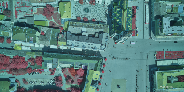
MapSoft – Multi-sensor Aerial System Improves Urban Development
Geospatial
NV5 Geospatial – Capturing Precise Details, with Four Phase One Cameras Integrated into Helicopter-based CLASS

Press Release
Carbonix, RIEGL, Phase One announce first fixed-wing VTOL integration of long-range dual sensor system

Geospatial Blog
Insights and future trends at Geo Week 2024

Press Release
Phase One Appoints HALG | Hindustan Assistant & Logistic Group as Official Technical Partner in India to Enhance Local Support and Engagement
Press Release
Phase One Introduces PAS Pana at InterGeo 2023: The Most Effective Wide Area Camera for Aerial Mapping

Press Release
Phase One announces New Calibration Lab and Geospatial Center of Excellence in Denver