Environmental & Conservation
Monitoring Birds and Environmental Influences
Assessing the effects of offshore windfarms over protected species spawns a need for innovative digital aerial survey methods to replace classical aerial visual surveys.
A Growing Need for Digital Survey Methods
The Institute for Applied Eco-System Research (IfAÖ) is a privately held research and consulting company in Germany that monitors, analyses and evaluates terrestrial and aquatic ecosystems, since 1993. IfAÖ provides research and consulting services for commercial clients as well as state and federal authorities, especially for the offshore windfarm development sector. Offshore wind farm projects require large-scale ecological surveys before, during, and after construction, in order to assess potential effects on the distribution and abundance of protected species.
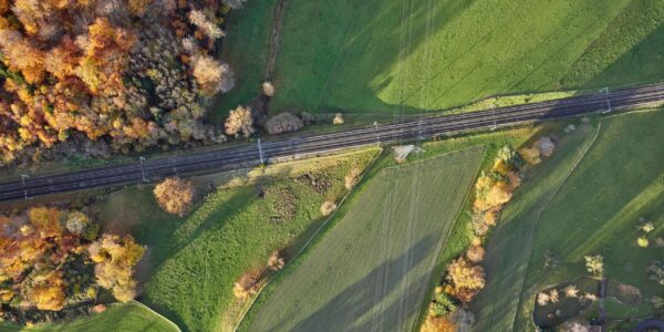
Classical aerial visual surveys are limited to low flight altitudes of 250ft. This challenges of real time visual classification/quantification for the observer, disturbance effects on sensitive bird species, and has become a significant safety risk inside wind farms for the crew, due to the rotor-sweep zone of the wind turbines. Aerial surveys, which can be carried out at higher (safer) flight altitudes beyond the swept zone, could technically solve these problems.
The German Federal Maritime and Hydrographic Agency (BSH) has since 2013, required the use of aerial digital imaging methods for assessing the impact of offshore windfarms which has stimulated the refinement of classical survey methods used by the IfAÖ.
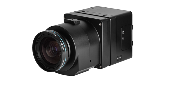
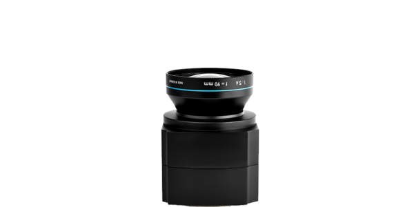
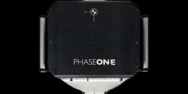
Phase One cameras are robust and easy to handle. They have a long-time reliable performance and their lenses are easy to change and to calibrate. By the plug and play design for the multi head configuration using the Daisy Chain connection, which is an all over the Phase One family topic, different cameras can be arranged in an array specified for our needs.
Development of an aerial digital survey equipment- Integration of Phase One camera
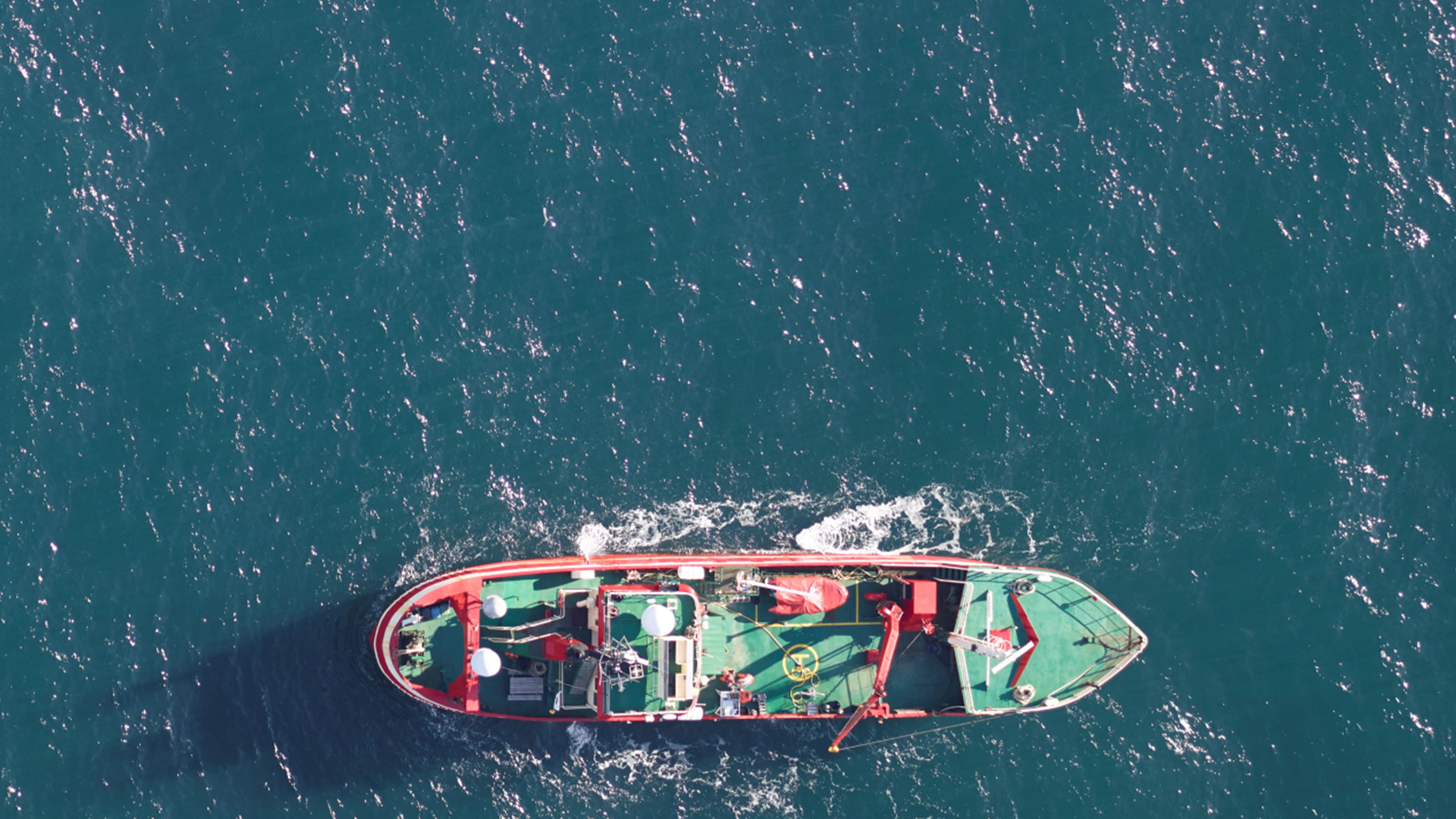
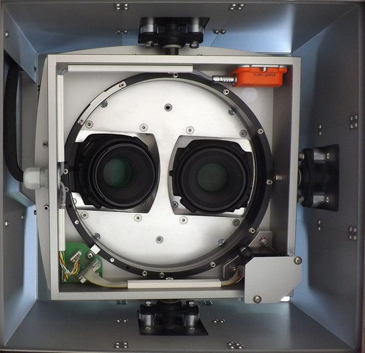
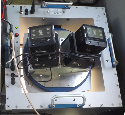
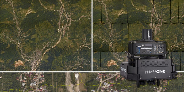
IfAÖ started to investigate digital aerial methods in 2011 and began a development program for new survey equipment in December 2013. The company consulted with GGS GmbH, a Phase One system integrator and hardware provider to tailor and build technical solution. With a survey area of 2,000SqKm, a minimum coverage of 10% of this area that can be sampled in one day with an overlap of 30% between the images. The use of a dual-camera design with Phase One 80MP medium-format cameras and 110mm lenses was proposed and tested. The equipment enables photographic flights at altitudes over 1300 ft (~400m) with a ground sampling distance (GSD) of 2cm. The cameras were integrated with the GGS AeroStab gyro-stabilized platform with GNSS-INS and a camera control interface.
Testing the System
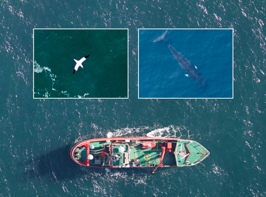
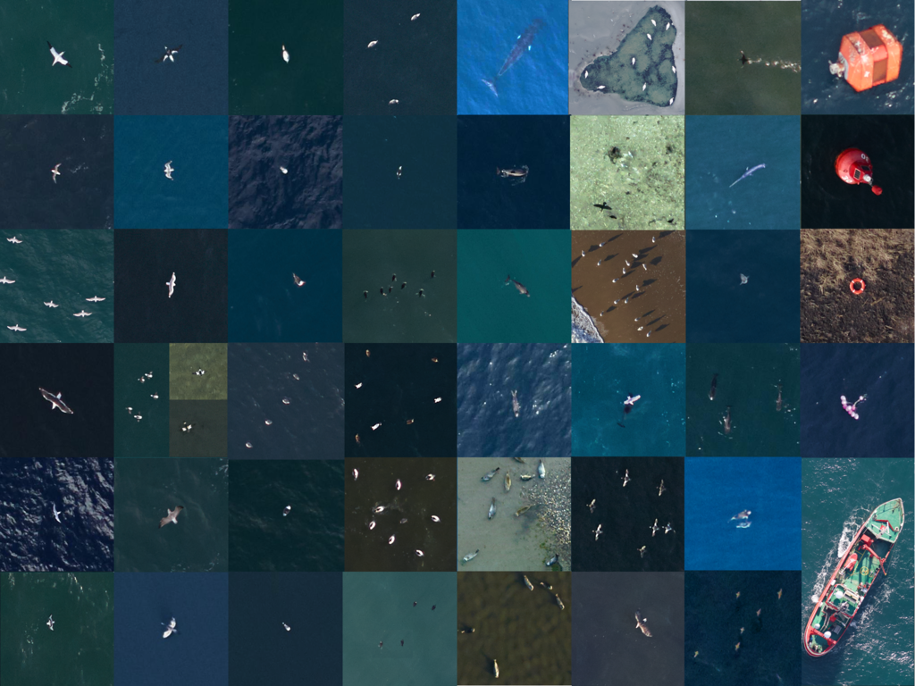
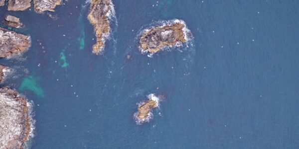
The first monitoring test took place in the Pomeranian Bight area of the Baltic Sea in winter when populations of Common Eider, Long-tailed Duck, Common Scoter and Velvet Scoter are extremely high to allow for easy counting and distinguishing of the different species. To test the robustness and the suitability for commercial use, the project included a coverage of 1,500SqKm with 10 flight lines – each of 50km length. The survey was carried out in six hours and 6,300 images were captured from an altitude of 1,400feet above sea level at a cruising speed of 100knots. The system’s performance was robust and the acquisition ensued without any image loss. A later analysis showed good results, which exceeded the team’s expectations in quality and resulted in a high match compared to ship based observations, which ran concurrently. Further test surveys in the spring addressed the limits of light and weather conditions, the detection possibilities for marine mammals and the extension of the survey runtime up to 8 hours a day.
Setting New Standards
The following autumn, the remote sensing equipment, now called DAISI, became the standard tool for the IfAÖ and was used now on a monthly later weekly basis with robust functionality and extended performance (BSH requirements) including:
- A maximal size of survey area of 3000SqKm and 10% coverage of this area.
- A transect length of approx. 700km at an operation velocity of 100-120kn
- Acquisition performance: 7500 images per camera, survey with a maximum eight hours operation time
- Images have a footprint of 150x400m with a 2cm GSD that allows the identification and classification of seabirds and marine mammals in general to species level.
In its first year the remote sensing system DAISI was successful used in 9 monitoring programs and produces approximately 560,000 images during 56 surveys.
A Glimpse into the Future
In order to meet the challenges of growing annual flight campaigns, conceptual studies for a second remote sensing system were carried out. The main objective was to design a new robust long-term running remote system. One key component was the Phase One 00MP camera which was equipped with CMOS sensor technology and an innovative electromagnetic central leaf shutter to enhance the capture rate and speed. In addition, with its precise image quality, the technical features promised convergence towards competing for video systems while providing extremely high image resolutions and the continued use of classical aerial imaging and processing techniques. The 100MP camera will increase the sampling rate to 1Hz, reduce the GSD down to 1.7-1.5cm and maintain the same footprint of 150 x 400m. The enhancements will improve object identification and image processing robustness. The associated increase in the image quantity influences the manual screening capacities for the identification of the avifaunistic features. To be able to manage this challenge, modern image processing methods for the exclusion of image parts with empty water surfaces and automatic object classification based on Deep Learning algorithms are therefore subject of current development work at the IfAÖ.
Contact a Phase One Expert
If you would like to learn more about our Aerial Cameras, our experts are eager to help! Contact Us.

Geospatial
The PAS Pana: a 48,800-pixel camera innovated with our customer Surdex

Geospatial
Rebuilding after Hawaii’s wildfire with engineering-grade surveying

Geospatial
Revolutionizing Slovenian urban planning: Phase One’s PAS 880i redefines reality mapping
Geospatial
Imaging solutions combined with AI and 5G – A new approach and promising to assess forest health and detect and monitor wildfires
Geospatial
Phase One Cameras combined with light, fixed-wing aircraft deliver highly efficient LiDAR and mapping missions
Geospatial
Capturing Glastonbury Festival
Geospatial
Breaking barriers to offshore wind energy development
Geospatial
Using aerial oblique images combined with close range UAV (uncrewed aerial vehicles) based data
Geospatial
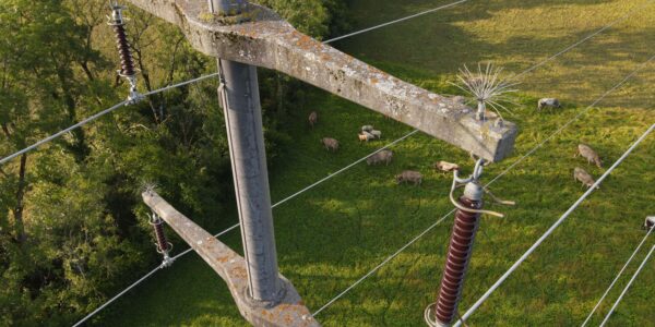
A change in the future of high-risk, critical asset inspections: fast, effective and safe aerial powerline inspection in a fraction of time and with real cost savings
Geospatial
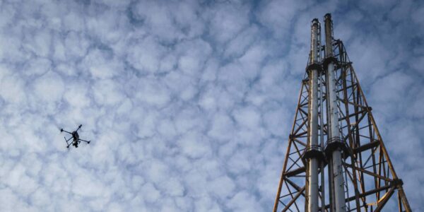
Using drone technology for Flare Stack Inspection: Getting the smallest details from a safe distance
Geospatial
The Experiences of EyeFly with Phase One iXM
Geospatial
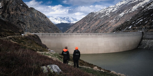
Dam Fine Data: Sub-millimeter-resolution UAV Dam Surveys by Orthodrone
Geospatial
Trimble Inpho – High class photogrammetry with aerial imagery from PAS 280
Geospatial
MapSoft – Multi-sensor Aerial System Improves Urban Development
Geospatial
NV5 Geospatial – Capturing Precise Details, with Four Phase One Cameras Integrated into Helicopter-based CLASS

Press Release
Carbonix, RIEGL, Phase One announce first fixed-wing VTOL integration of long-range dual sensor system

Geospatial Blog
Insights and future trends at Geo Week 2024

Press Release
Phase One Appoints HALG | Hindustan Assistant & Logistic Group as Official Technical Partner in India to Enhance Local Support and Engagement
Press Release
Phase One Introduces PAS Pana at InterGeo 2023: The Most Effective Wide Area Camera for Aerial Mapping

Press Release
Phase One announces New Calibration Lab and Geospatial Center of Excellence in Denver