Agriculture & Forestry
Phase One 100MP 4-Band System Integration by GGS: One Solution; Multiple Applications
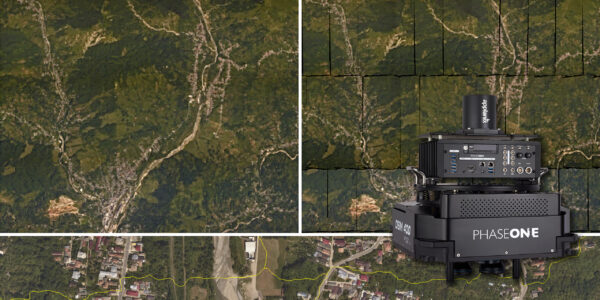
GGS GmbH from Germany, one of Phase One‘s integration partners, has an excellent reputation for innovation and integrating IMU/GNSS and flight management system (FMS) solutions. Dr. Gerhard Kemper, owner of GGS, trailed Phase One 100MP 4-Band metric cameras in several commercial projects to develop a system that could be used in multiple applications.
Smooth Integration
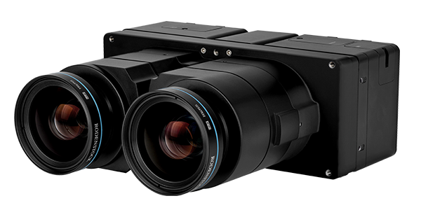
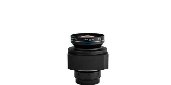
Phase One’s iXU-RS1900 camera offers exceptional aerial image coverage, high accuracy, and quality, presenting an excellent alternative to traditional large format cameras in diverse aerial survey applications such as mapping, 3D City modeling, remote sensing, precision agriculture, disaster management and monitoring. Aerial missions with the dual head configuration become highly productive when compared with a single camera setups.
Phase One’s 100MP 4-band system is a well-integrated and flexible solution for different tasks in aerial surveying projects. The iXU-RS1900 is combined with an additional achromatic iXU-RS1000 camera with 50mm lens, to simultaneously capture RGB and NIR images thus providing 4-Band (R,G,B,NIR) or CIR imagery. iX Capture software supports a perfect workflow to create the requested images for various projects.
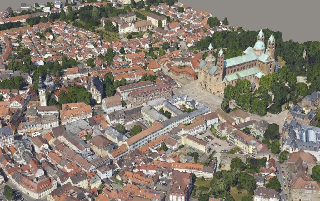
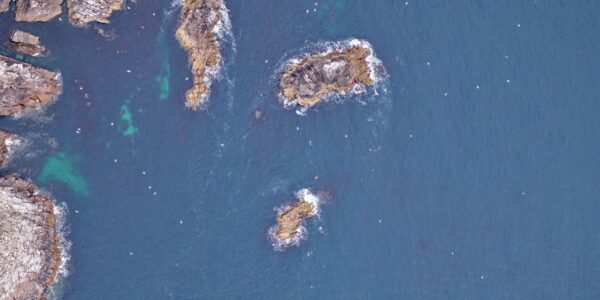
The 4-band system mounted on GGS’s AeroStab-M fully compensated gyro-stabilizer is a very flexible and powerful combination that effectively covers vast areas. The AeroStab-M can host 3 to 4 Phase One cameras, with a hole diameter of just 240mm. In combination with AeroTopoL (flight management system) FMS several evaluation missions were performed with a Cessna 206 over the city of Speyer, Germany.
Image: 3D Model of Speyer, Germany – GGS 2018 ©
We love to integrate Phase One technology into our turnkey solutions!
Industrial Site Survey
Peter Schmitt (Dipl.-Ing.), publicly appointed surveyor, was assigned to update the facilities of Pfalz Flugzeug Werke in Speyer.
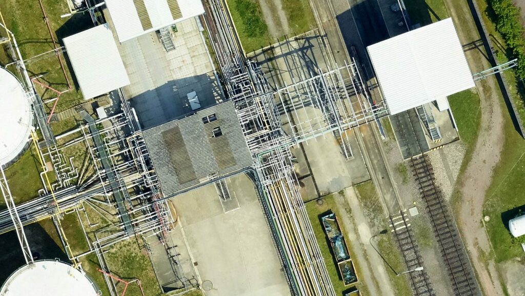
“In the past, the infrastructure of industrial areas was updated with classical surveys, GPS and Total Stations. High-resolution aerial images from Phase One are now used to generate true orthophotos and close the gaps where surveys of complex infrastructure cannot be applied using classical methods alone. Results are amazing with a resolution of 3.5cm ground sample distance (GSD), which provides clients with a good planning dataset, perfectly fulfilling their requirements.”
Image: True Orthophoto of Industrial Facilities- GGS GmbH 2018 ©
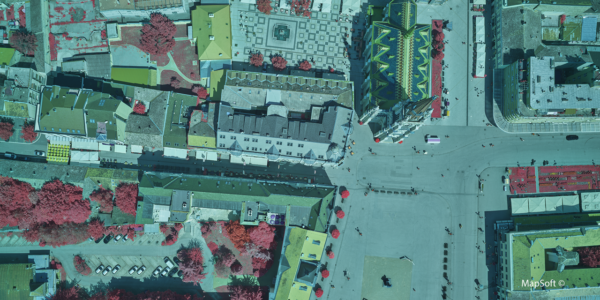
City Planning and Urban Green
City planners can now receive high resolution images and/or orthophotos in RGB and CIR for use in different tasks within the municipality.
“The quality of information we now receive with the Phase One technology and GGS system is outstanding and the CIR images are perfect to assist the department of Municipal Green Management to check the health status of the trees, for example.” Patrick Kürten, responsible for the data management of the city of Speyer has to support various departments of the city management with the central Geographic Information System (GIS).
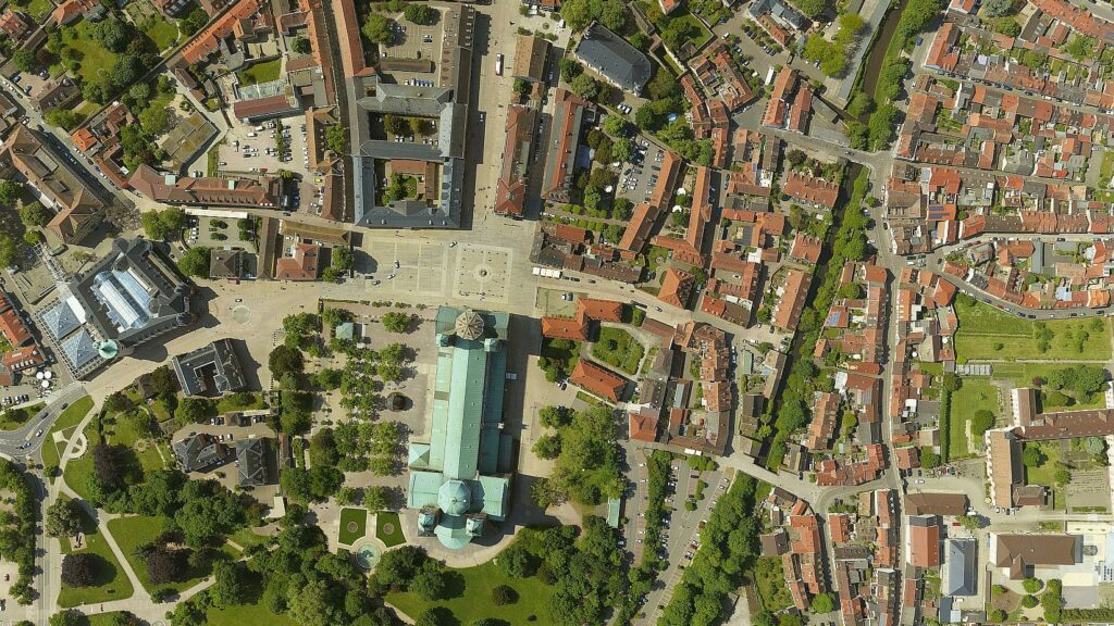
“The municipality is also eager to use such detailed images for developing 3D models of Speyer. Digitally preserving the cultural heritage of the city requires high resolution data.”
Image: Orthophoto of Speyer Cathedral and surrounding park, Germany – GGS GmbH 2018 ©
Flood control and Eco-balance
Data has been provided to both planning teams for Struktur- und Genehmigungsdirektion Süd (Structural and Approval Directorate South) and to Neubaugruppe Hochwasserschutz Oberrhein” (New Construction Group Flood Protection Upper Rhine) for planning and environmental issues.
Heinz-Peter Wierig, Ecological Protection, Struktur- und Genehmigungsdirektion Süd:
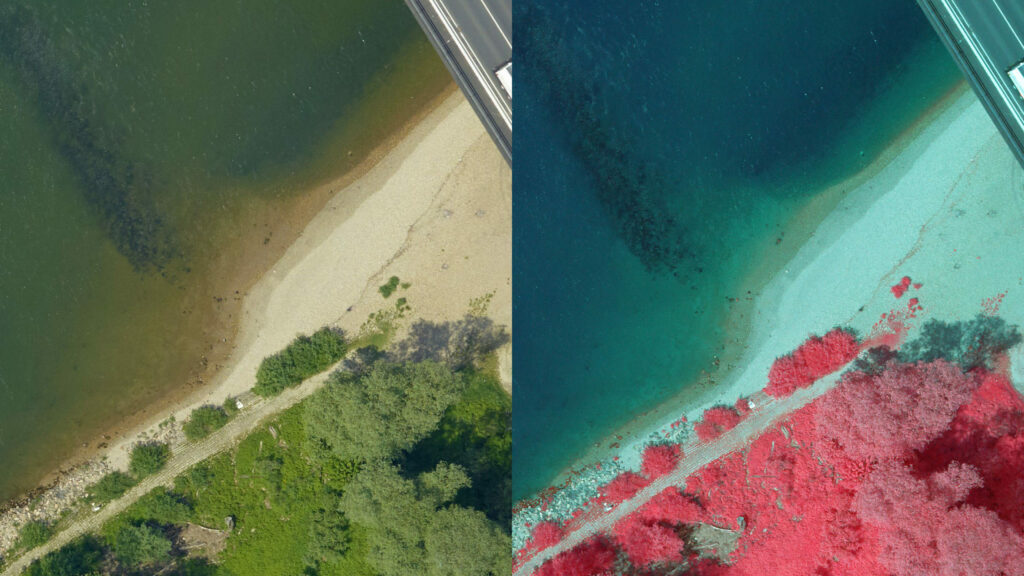
“We would be delighted to use this quality of data for our entire project area. The data we received for the Rhine valley, south east of Speyer is a fantastic resource for our flood prevention planning which also includes the environmental issues of the Natura 2000 reservation. The extremely high resolution of 2cm GSD in RGB and NIR shows fine details we haven’t been able to see until now. We can now zoom further into details which help us to protect sensitive ecological areas much better than we used to.”
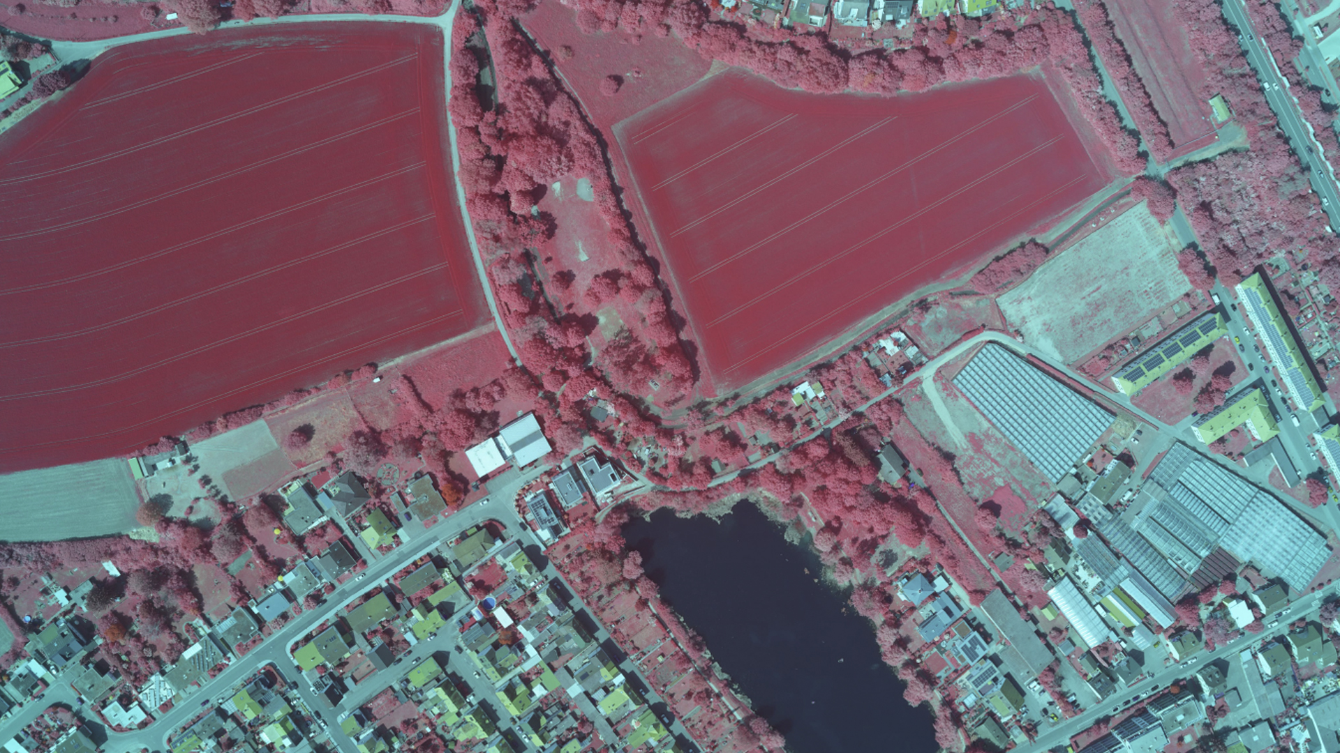
Image:The Rhine with dikes and ecological areas – GGS GmbH 2018 ©
Municipal Action Group for the Elimination of Midge Infestation – (KABS – Kommunale Aktionsgemeinschaft zur Bekämpfung der Schnakenplage)
Klaus Hoffmann, responsible for the GIS system at KABS. “Using extremely high resolution RGB and NIR data offers us new opportunities. The department operates in a very sensitive ecological area. All flooded areas and old river tributaries are usually located in a protected environment. The incubation period of midges is a serious issue that varies from year to year depending on the climate and hydrological situation.”
The department needs detailed data to quickly identify areas where an infestation may conflict with environmental protection, especially bird breeding. KABS cooperates with several ecological institutes and universities, and this type of data provides an important dataset in their GIS.
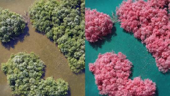
Image: Typical breeding area in RGB & CIR – GGS GmbH 2018 ©
Contact a Phase One Expert
If you would like to learn more about our Aerial Systems, our experts are eager to help! Contact Us.

Geospatial
The PAS Pana: a 48,800-pixel camera innovated with our customer Surdex

Geospatial
Rebuilding after Hawaii’s wildfire with engineering-grade surveying

Geospatial
Revolutionizing Slovenian urban planning: Phase One’s PAS 880i redefines reality mapping
Geospatial
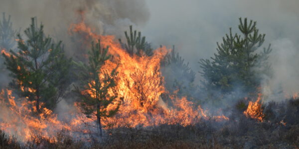
Imaging solutions combined with AI and 5G – A new approach and promising to assess forest health and detect and monitor wildfires
Geospatial
Phase One Cameras combined with light, fixed-wing aircraft deliver highly efficient LiDAR and mapping missions
Geospatial
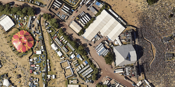
Capturing Glastonbury Festival
Geospatial
Breaking barriers to offshore wind energy development

Geospatial
Using aerial oblique images combined with close range UAV (uncrewed aerial vehicles) based data
Geospatial
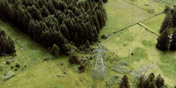
A change in the future of high-risk, critical asset inspections: fast, effective and safe aerial powerline inspection in a fraction of time and with real cost savings
Geospatial
Using drone technology for Flare Stack Inspection: Getting the smallest details from a safe distance
Geospatial
The Experiences of EyeFly with Phase One iXM
Geospatial
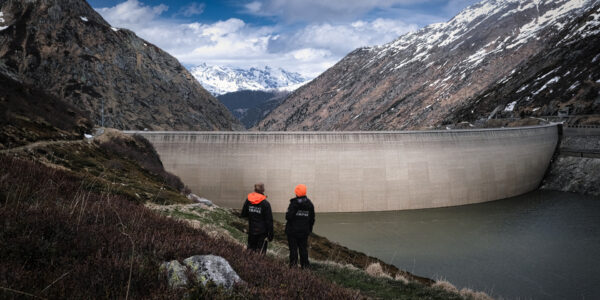
Dam Fine Data: Sub-millimeter-resolution UAV Dam Surveys by Orthodrone
Geospatial
Trimble Inpho – High class photogrammetry with aerial imagery from PAS 280
Geospatial
MapSoft – Multi-sensor Aerial System Improves Urban Development
Geospatial
NV5 Geospatial – Capturing Precise Details, with Four Phase One Cameras Integrated into Helicopter-based CLASS

Press Release
Carbonix, RIEGL, Phase One announce first fixed-wing VTOL integration of long-range dual sensor system

Geospatial Blog
Insights and future trends at Geo Week 2024

Press Release
Phase One Appoints HALG | Hindustan Assistant & Logistic Group as Official Technical Partner in India to Enhance Local Support and Engagement
Press Release
Phase One Introduces PAS Pana at InterGeo 2023: The Most Effective Wide Area Camera for Aerial Mapping

Press Release
Phase One announces New Calibration Lab and Geospatial Center of Excellence in Denver