3D Modeling
Creating 3D City Models in a Single Flight
3D urban mapping is required by more cities at a rapid rate. Aerowest GmbH of Dortmund, Germany has been using IGI’s UrbanMapper with eight Phase One 100-megapixel cameras acquiring aerial data for 3D city modeling in a fast, efficient and cost effective way.
Efficiency in Vertical and Oblique Aerial Photography Collection
In the last decade, oblique camera aerial systems were introduced into many diverse aerial imaging applications. System uses include but are not limited to: multi-perspective desktop viewers, visualization of buildings roofs and façades from a 360-degree perspective, realistic texturing of 3D City models, and measurement of building heights in monoplotting mode.
Today urban planners and decision makers rely on 3D City modeling to support a wide variety of initiatives and actions. 3D city models are used to prepare for changes in city structures, population growth and urban planning, preventative measures for natural and industrial disasters, inhibiting overuse of finite resources, incorporating sustainable practices, and more. City planners therefore require a reliable database that can be easily modified over time in order to gain a holistic look at the urban environment. An immediate advantage of acquiring oblique images is the possibility to view elements that are generally occluded or not visible in the vertical views.
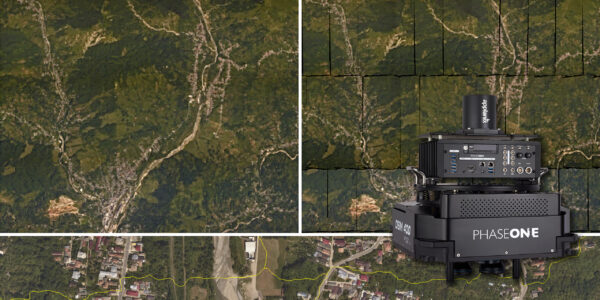
Aerowest GmbH has provided acquisition and processing of geospatial data from aerial photographs since 1970. In February 2017 they integrated eight Phase One Industrial 100MP cameras into an IGI UrbanMapper for acquiring data for aerial 3D models in a fast, efficient, and cost-effective way.
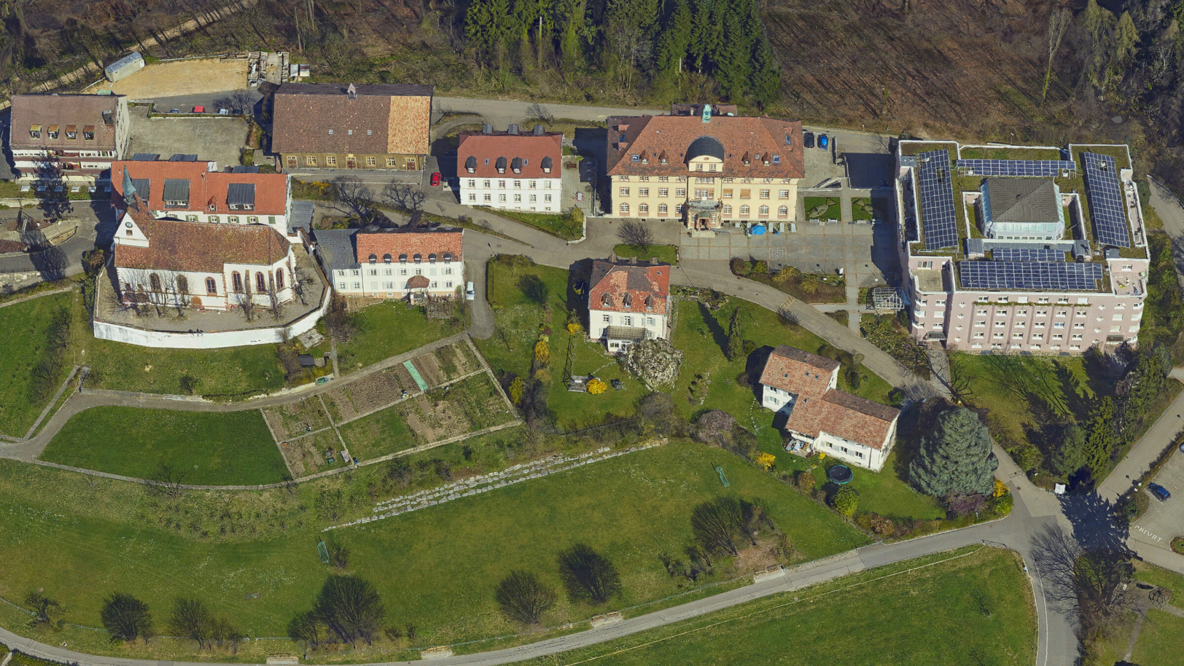
Image: 3D Mesh Model – Courtesy of Aerowest. 2018 ©
The quality and reliability of Phase One cameras is outstanding. Due to the high sensitivity of the camera, the IGI UrbanMapper can be operated under poor light conditions and at high aircraft speed while still retaining high-quality image capture. In 2 years we have successfully shot more than 1.2 million images.
IGI and Aerowest complete a project of catching a large-format NADIR and oblique aerial imagery in one single flight with the Urban Mapper that integrates eight Phase One 100MP cameras.
Capture Multiple Perspectives Simultaneously
Aerowest combines both worlds with the newly developed IGI UrbanMapper system, which joins high-resolution nadir and oblique images in one single system setup. Combining high geometric stability and high quality images allows urban planners zoom into the finest details. Cameras used in the UrbanMapper need to have a high dynamic range to accommodate for different light conditions (such as shadowed areas) and a high resolution.
IGI’s UrbanMapper comprises of 8 Phase One 100 megapixel cameras that capture multiple perspectives simultaneously with high overlap. The camera system is installed in a gyro-stabilized platform and operated with an IGI’s AEROControl GNSS / IMU system. This allows the exact determination of each exposure position and image orientation. This system enables the capturing of large-format nadir and oblique aerial imagery in a single flight.
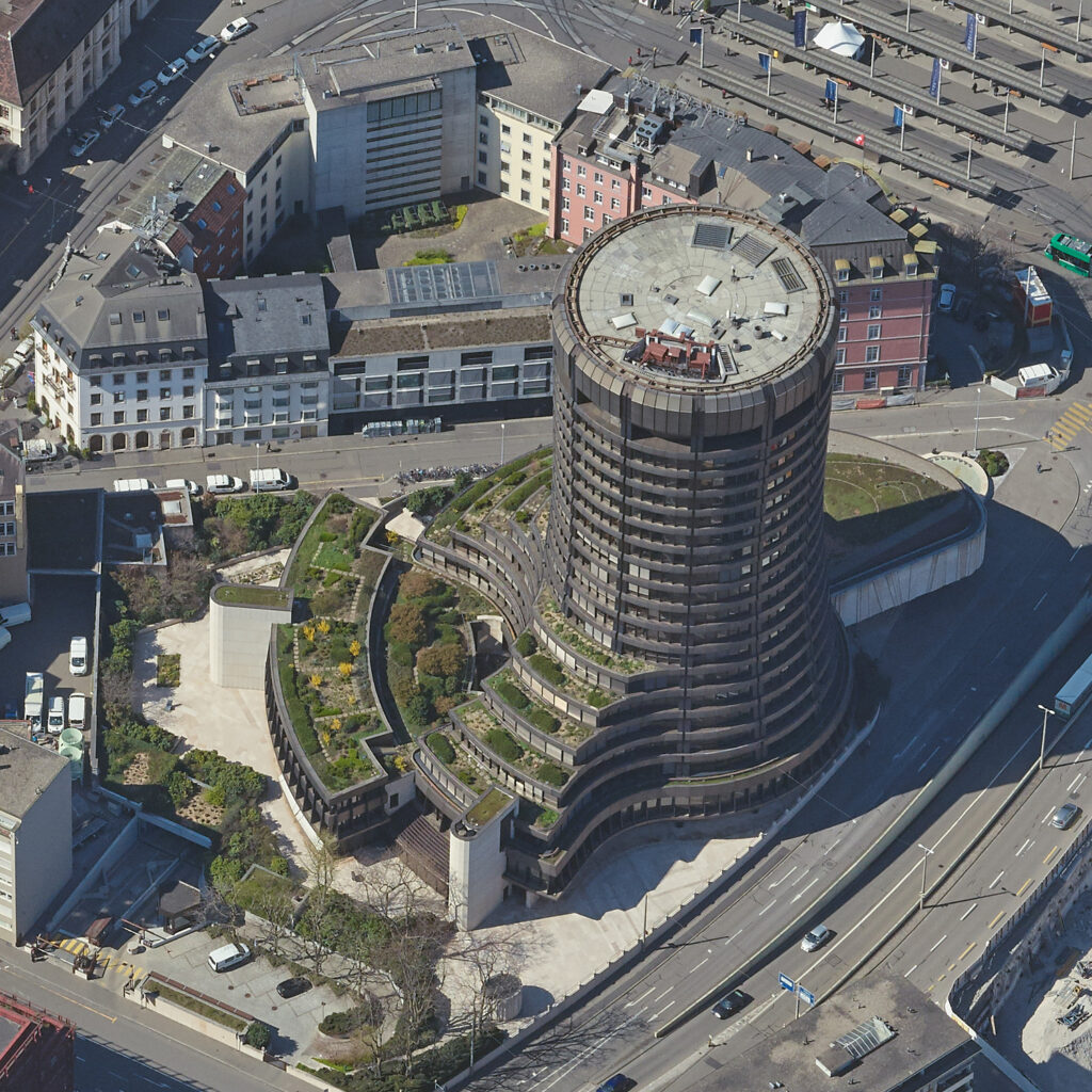
Image: High-resolution 100 Megapixel Oblique Aerial Image – BVB-Noord – Courtesy Aerowest GmbH. 2020 ©
High Performance with Phase One Cameras
Hans Joachim Benfer, Aerowest CEO explains that the unique aerial sensor system simultaneously captures nadir and oblique images with a forward overlap of more than 80% even with highest resolution up to GSD of 2cm.
“Based on the short exposure time and the highly sensitive CMOS sensors we can collect images at a flight altitude of 2,000m (6,500 feet) with the same or even better image quality as camera systems operated in light aircraft or drones from lower flight altitudes”, says Benfer.
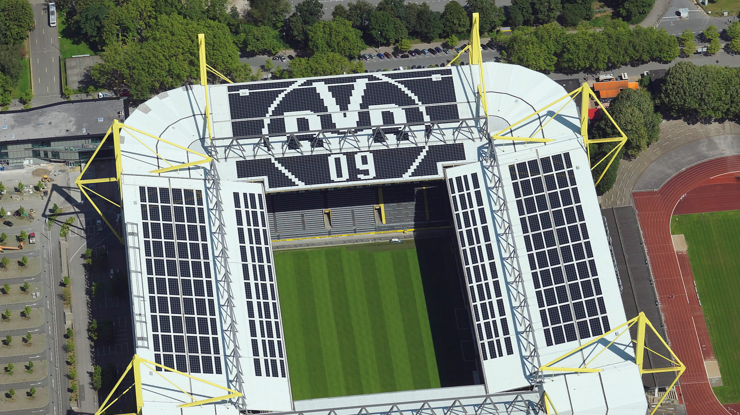
Image: Oblique image zoomed – Courtesy Aerowest GmbH 2018 ©
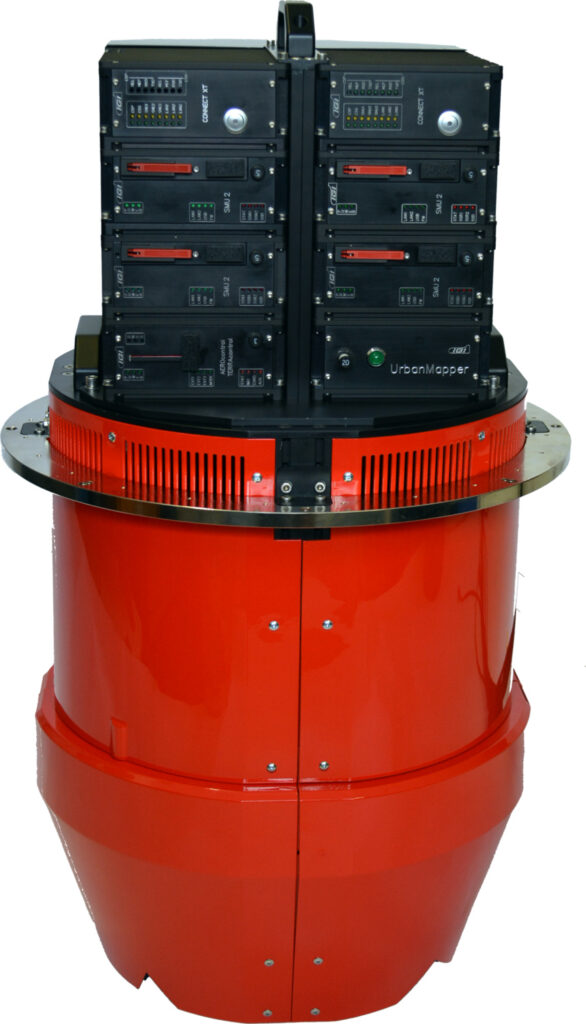
The UrbanMapper
The IGI UrbanMapper comprises:
- 3 Phase One 100MP cameras mounted in cross track
- 1 Phase One 100MP camera – NIR
- 4 Phase One 100MP cameras – Oblique
- Sensor Technology: Phase One BSI-CMOS
- High Dynamic Range of 84dB
- Channels: RGB, RGB + CIR
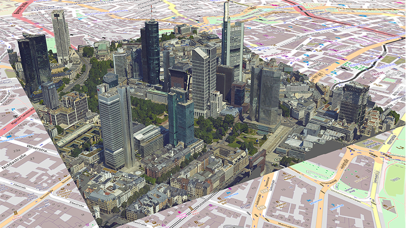
Image: 3D city model of Frankfurt – Courtesy Aerowest GmbH 2018 ©.
Generating Online City Models
Each Phase One Industrial camera contains a 100MP CMOS sensor and each lens utilizes innovative RS shutters. A fast capture rate of 0.6 sec per image, and the high performances of Phase One Industrial RS lenses, integrated with an IGI processor, lead to outstanding image quality. The system is able to provide a 2cm Ground Sample Distance (GSD) at 400m flying altitude; 5cm GSD at 1000m flying altitude. A forward overlap of >80% is achievable at 120kn flying speed.
The UrbanMapper with its eight Phase One 100MP aerial cameras captures a huge amount of data. Processing this data and generating a comprehensive and detailed model out of it takes time. Aerowest uses SURE Aerial software by nFrames GmbH and PHOTOMESH software by Skyline Software Systems Inc. side-by-side to produce textured 3D models of cities. The oriented images can be processed with any matching or photogrammetric software on the market. Even smaller municipalities can now achieve cost effective, high-quality 3D city models as well as orthophotos with an accuracy of two to ten centimeters.
Multi-perspective aerial imaging opens many new opportunities in geodata based applications. Aerial imaging with qualified cameras offers the fastest way to reproduce digital 3D representation of reality for all kinds of planning, surveying or visualization.
3D city models are generated fully automatically from high-resolution multi-perspective aerial photos. A coherent surface, the so-called 3D mesh, is derived from the 3D PointClouds and textured throughout. Alternatively, 3D buildings can also be captured and textured using object-oriented methods. In this way, photorealistically modeled 3D buildings can be linked to any material data (e.g. ALKIS). Aerowest delivers and updates textured city models in CityGML format as standard.
Image: UrbanMapper by IGI – Courtesy Aerowest GmbH. 2020 ©
Contact a Phase One Expert
If you would like to learn more about our Aerial Cameras, our experts are eager to help! Contact Us.

Geospatial
The PAS Pana: a 48,800-pixel camera innovated with our customer Surdex

Geospatial
Rebuilding after Hawaii’s wildfire with engineering-grade surveying

Geospatial
Revolutionizing Slovenian urban planning: Phase One’s PAS 880i redefines reality mapping
Geospatial
Imaging solutions combined with AI and 5G – A new approach and promising to assess forest health and detect and monitor wildfires
Geospatial
Phase One Cameras combined with light, fixed-wing aircraft deliver highly efficient LiDAR and mapping missions
Geospatial
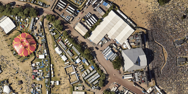
Capturing Glastonbury Festival
Geospatial
Breaking barriers to offshore wind energy development
Geospatial
Using aerial oblique images combined with close range UAV (uncrewed aerial vehicles) based data
Geospatial
A change in the future of high-risk, critical asset inspections: fast, effective and safe aerial powerline inspection in a fraction of time and with real cost savings
Geospatial
Using drone technology for Flare Stack Inspection: Getting the smallest details from a safe distance
Geospatial
The Experiences of EyeFly with Phase One iXM
Geospatial
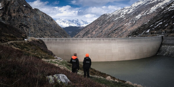
Dam Fine Data: Sub-millimeter-resolution UAV Dam Surveys by Orthodrone
Geospatial
Trimble Inpho – High class photogrammetry with aerial imagery from PAS 280
Geospatial
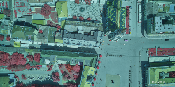
MapSoft – Multi-sensor Aerial System Improves Urban Development
Geospatial
NV5 Geospatial – Capturing Precise Details, with Four Phase One Cameras Integrated into Helicopter-based CLASS

Press Release
Carbonix, RIEGL, Phase One announce first fixed-wing VTOL integration of long-range dual sensor system

Geospatial Blog
Insights and future trends at Geo Week 2024

Press Release
Phase One Appoints HALG | Hindustan Assistant & Logistic Group as Official Technical Partner in India to Enhance Local Support and Engagement
Press Release
Phase One Introduces PAS Pana at InterGeo 2023: The Most Effective Wide Area Camera for Aerial Mapping

Press Release
Phase One announces New Calibration Lab and Geospatial Center of Excellence in Denver