Phase One Unveils PAS 880 Large-Format Nadir & Oblique Aerial Camera System
Accurate and Affordable 2D/3D Aerial Mapping
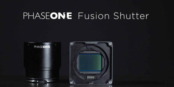
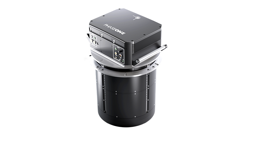
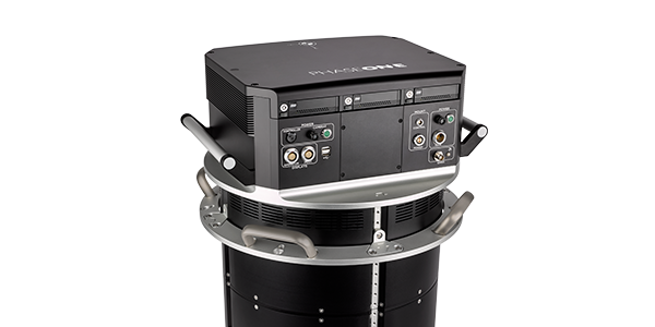
COPENHAGEN, 15 December 2020 – Phase One, a leading provider of geospatial solutions, today unveiled the PAS 880 fully integrated large-format nadir and oblique camera system for aerial mapping. The PAS 880 integrates a 280-megapixel (MP) nadir camera with four oblique 150 MP cameras into a single pod to simultaneously capture photogrammetric 2D and 3D digital imagery.
“The outstanding image quality and accuracy combined with unsurpassed data collection rate make the PAS 880 the most productive large-format aerial mapping solution on the market today, based on established Phase One technology,” said Dov Kalinski, Phase One VP of Geospatial Business.
Operating at a remarkable 2 frames/second capture rate, the PAS 880 covers extremely wide flight lines with 20,000 pixels across in nadir and 14,000 pixels in each of the oblique angles. The system can be operated at a variety of airspeeds, altitudes, and lighting conditions for cost-effective blur-free image collection, with a maximum spatial resolution of 2.5 centimeters at 600 meters altitude. The combination of 90mm nadir and 150mm oblique camera lenses ensures balanced ground resolution.
The high-resolution 2D imagery collected by the PAS 880 will meet or exceed traditional photogrammetric nadir mapping requirements supported with oblique images, while the combination of nadir and oblique for 3D data will be ideal for city mapping and related applications where a 360-degree perspective is required. These include Smart City management such as municipal planning and environmental monitoring as well as insurance, asset inventories, tax assessment, computer simulations, reality/digital twin capture, and mass modeling.
“We designed the PAS 880 with the same reliability and affordability our aerial mapping customers have come to expect from a Phase One system, ensuring an ROI that is unmatched by other oblique and nadir systems,” said Kalinski.
As is true of all Phase One Aerial Systems, the PAS 880 is a tightly coupled hardware and software system. Each system is delivered with a seamlessly integrated high-level GNSS/IMU, where customers can choose between two accuracy levels.
The PAS 880 comes equipped with the new generation of Phase One sensor and flight management software, developed for efficient, effective, and economical management of the entire oblique and nadir data capture workflow. The software includes iX Plan for mission planning; iX Flight Pro for flight management, data collection and image-status monitoring; and iX Process for fast and high-quality image processing. Phase One designed an open system to allow for additional processing with third-party photogrammetric applications.
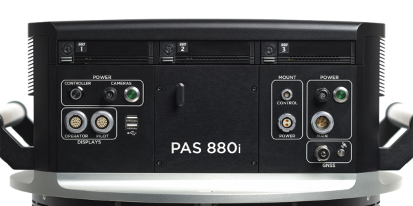
Other important features of the PAS 880 include:
- BSI CMOS sensor with extremely sharp 3.76-micron pixel size.
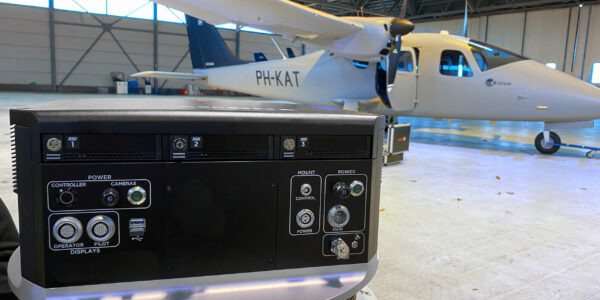
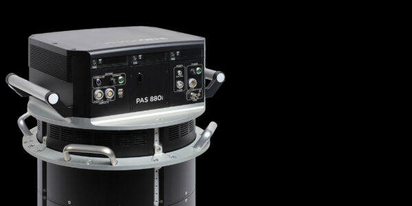
- The lightweight and compact camera pod installs easily in any common mapping aircraft.
- Blur Motion Control for Forward Motion Compensation.
- Dual views for pilot and navigator to monitor image quality in real-time.
- 12 TB storage with separate SSD for each camera.
- Ready for remote diagnostics and future updates.
For information on the Phase One PAS 880, visit here.
About Phase One
Phase One A/S is a leading researcher, developer and manufacturer of medium format and large format digital cameras and imaging Systems.
Founded in 1993, Phase One is a pioneer of digital photography. Phase One has developed core imaging technologies and a range of digital cameras and imaging modules, providing the world’s highest image quality in terms of resolution, dynamic range, color fidelity and geometric accuracy. As such, Phase One has grown to become the leading provider of high-end imaging technology across many demanding business segments, such as aerial mapping, industrial inspection and cultural heritage digitization, as well as serving the world’s most demanding photographers.
Based in Copenhagen, Denmark, and with regional offices in New York, Denver, Cologne, Tel Aviv, Tokyo, Beijing, Shanghai and Hong Kong, Phase One nurtures long-term relationships with customers, technology partners and its global network of distributors, often playing the role of digital imaging partner to customers with special requirements. It is with this passion for service that Phase One continually exceeds expectations and drives the imaging industry forward.
Learn more at https://geospatial.phaseone.com

Share this on social media: